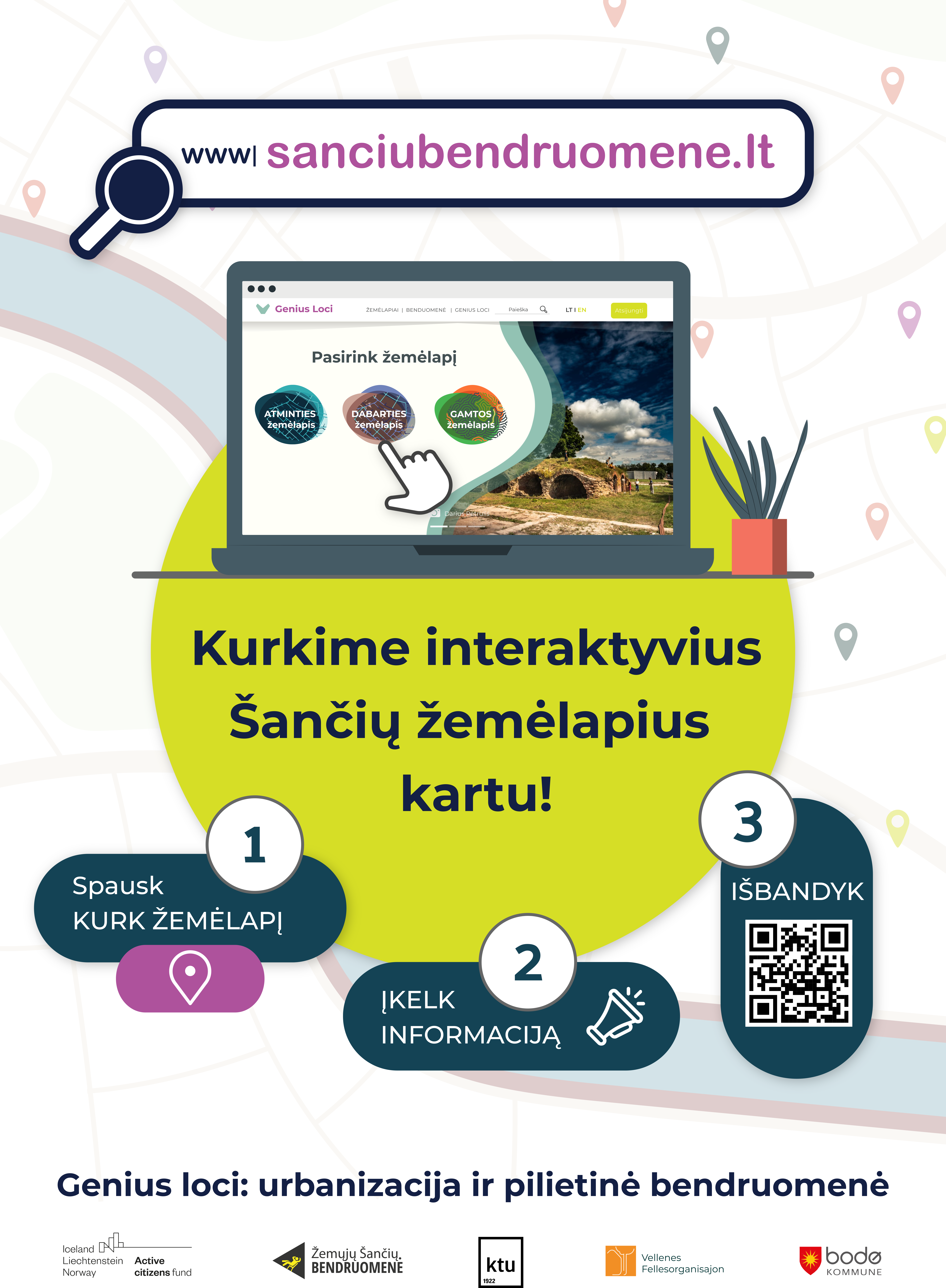
Genius Loci is an interactive digital mapping tool designed and made by citizens to safeguard the Šančiai district of Kaunas against top-down decision-making that prioritized private value above public interest. Each map represents local landmarks, nature, people and their stories. Together, the interactive maps and over 1,000 inputs form a data set to create a new sustainable vision for this urban neighbourhood, preserving its cultural heritage, landscape and environment.
European Economic Area (EEA) and Norwegian Financial Mechanisms 2020-23 with partners Kaunas Technological University, Vellenes Felleorganisasjon, Bodo Municipality and the coordinating partner, Zemuju Sanciu bendruomene.
Genius Loci is the creation of interactive digital maps that create data bank to inform the future urban development of Šančiai district. The maps are a tactic to safeguard against repeated violations of the the public interest by Municipal and private developers in which places are seen as 'tanbula rasa' in which profit value is extracted. Each map reflects the local people, place, stories and nature as created by local people. Together, the maps create conditions for more active participation in democratic processes, strengthening and enabling collective citizenship. The target group of the project is the activation and energization of the residents of Šančiai.
Objective:
Design and realize a digital tool for local people to spotlight their unique neighbourhood features using a Memory Map, a Present (sociotopic) Map and a Nature Map and create a new data set to inform future urban vision.
Results:
Šančiai community are more bonded having been activated by participation in map making and stronger civil society capacity nurtured;
New data set created provides information for more sustainable urban vision of the neighbourhood;
Partnerships deliver technical support and expert knowledge i.e. Kaunas Technological University helped to formulate map data, Bodo Municiaplity (Norway) helped articulate the tolerance of heritage for development and Faro Network gave permission to the idea that local residents are experts of their local heritage;
Digital tools promoting public participation and is acknowledged in Lithuania and beyond as a model of valuable practice.
Please highlight how the project can be exemplary in this context
This project is a stand alone module of a longer term community drama between April 2019 and February 2022. It has become a key building block in which we have created new data that will now inform a longer term urban vision of a local neighbourhood with a population of 20,000 inhabitants. The key objective is first about PEOPLE: "To activate the participation of groups not involved in decision-making in civic and urban planning activities." This includes: finding ways to entice citizens to be more actively involved in decision-making in civic activities; it includes working with the members of the Šančiai community. The second key objective is about PROCESS in which "To create a virtual community space enabling mapping process are build-upon an increase in the number of users of digital tools, thus promoting public participation in civic activities" Here sustainability 'is' community and its environment that has expressed it resilience to extractive urbanisation by protesting against Municipal plans and forms of top-down decision-making. Specifically, sustainability is expressed by an increased capacity of local residents for self-governance and participation in the principles of local democracy. Most importantly, the results are concrete and well documented so as to be available to much wider circle than our community and include: Mapping workshops and Capacity Building actions:
Digital tools: 1 digital GIS database, 11 creative workshops, 82 hours, 157 children and youth, 39 adults, 5 leaders, 3 interactive Mapping Layers including past (memory) present and nature maps.
Capacity building: 4 trainings using the, 125 participants, 9 facilitators
Direct democracy: 2 public presentations, 3 packages of proposals, 63 participants.
Mapping workshops: 3 lectures, 2 seminars, 2 excursions, 220 participants, 19 lecturers, 1 guide
Art and culture: 2 exhibition, 267 spectators; 6 community spaces, 195 participants, over 1,000 citizens
Please highlight how the project can be exemplary in this context
Community art was used as a tool for the community to have its voice heard. This was the case both in the protest phase of the project (see article referred to in links) and during the visioning phase in which the mapping platform was designed and realised. Together these phases articulate how community arts became a catalyst for action and examines how creative approaches have energised bottom-up and top-down activism. The principles of the Framework Convention on the Value of Cultural Heritage for Society (FARO) were used to understand how the community sought to safeguard its unique historic urban landscape and heritage. The mapping is a result of a shift from creative protesting as a response to two plans for a new road project along the River Nemunas, initiated by the Kaunas Municipality, which were both withdrawn as a result of successful interventions by the community but developed into a wider, public-interest and self-government campaign. The aesthetics of power over communities with its spending on branding and marketing has been relegated to an aesthetics of power with communities that must end in dialogue with Municipal authorities about participation in urban planning. Here culture and art are a central pillar of sustainability not simply 'for' or 'with' but 'as' community. The mapping was presented to peers during the Council of Europe Faro Convention annual assembly in Venice in December 2021 and during the European Commission funded Academy Camp #4 organised by Interarts and Francois Matarasso for all European Capital of Culture cities to build their capacity for engaging with communities. During these presentations of the mapping project there was acknowledgement that this process was a model of valuable practice that can have transversal effect far beyond its original context.
Please highlight how the project can be exemplary in this context
The vision of the mapping is a clarion call to residents, "Let's create Šančiai together!" by contributing to a platform for spatial planning of Šančiai neighborhood. Three maps are present:
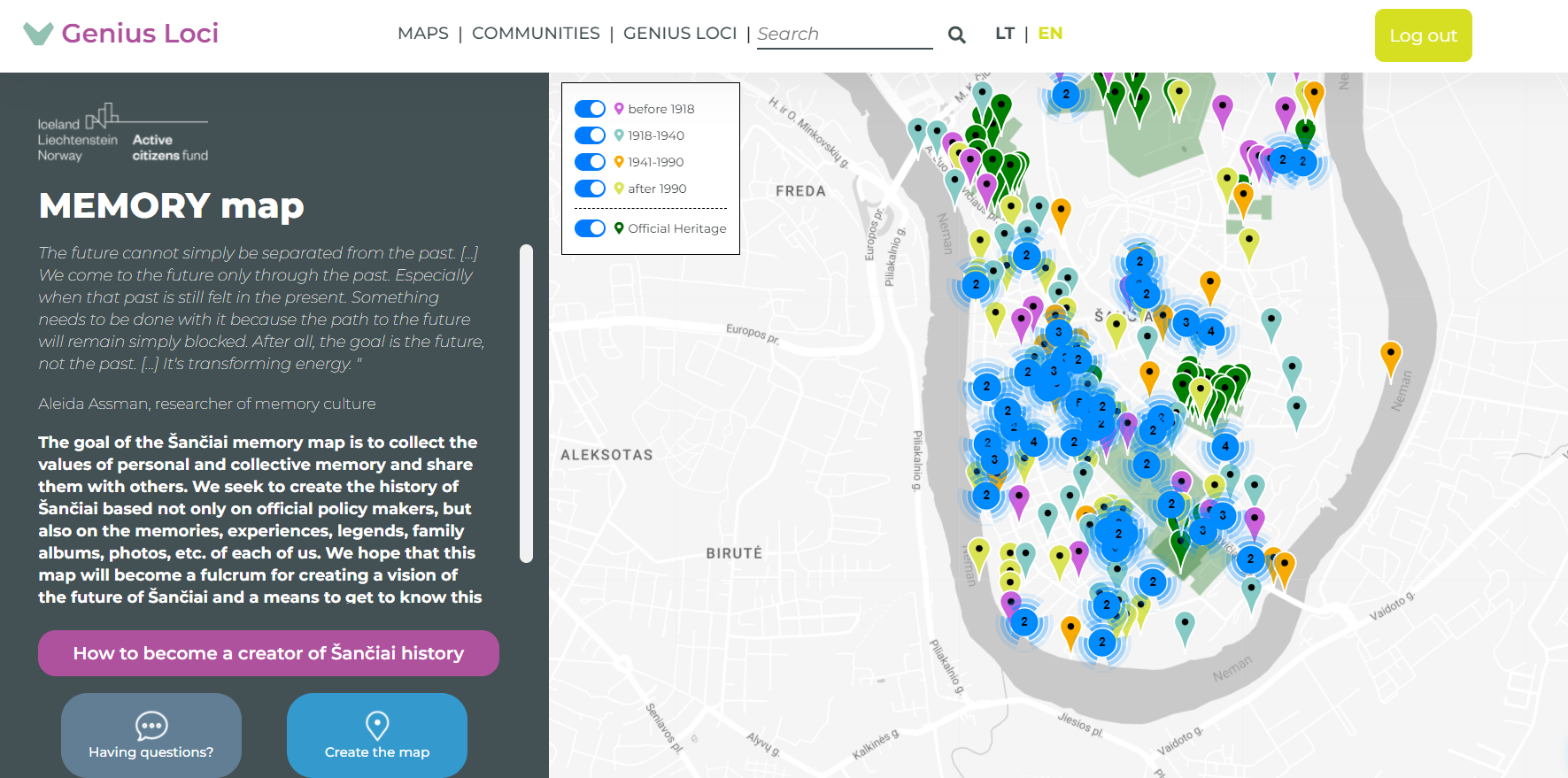
(1) MEMORY map because the future cannot simply be separated from the past. We come to the future only through the past. Especially when that past is still felt in the present. Something needs to be done with it because the path to the future will remain simply blocked. The goal of the Šančiai memory map was to collect the values of personal and collective memory and share them with others. We created a history of Šančiai based not only on official policy makers, but also on the memories, experiences, legends, family albums, photos, etc. of each of us. This map will become a fulcrum for creating a vision of the future of Šančiai and a means to get to know this area better.
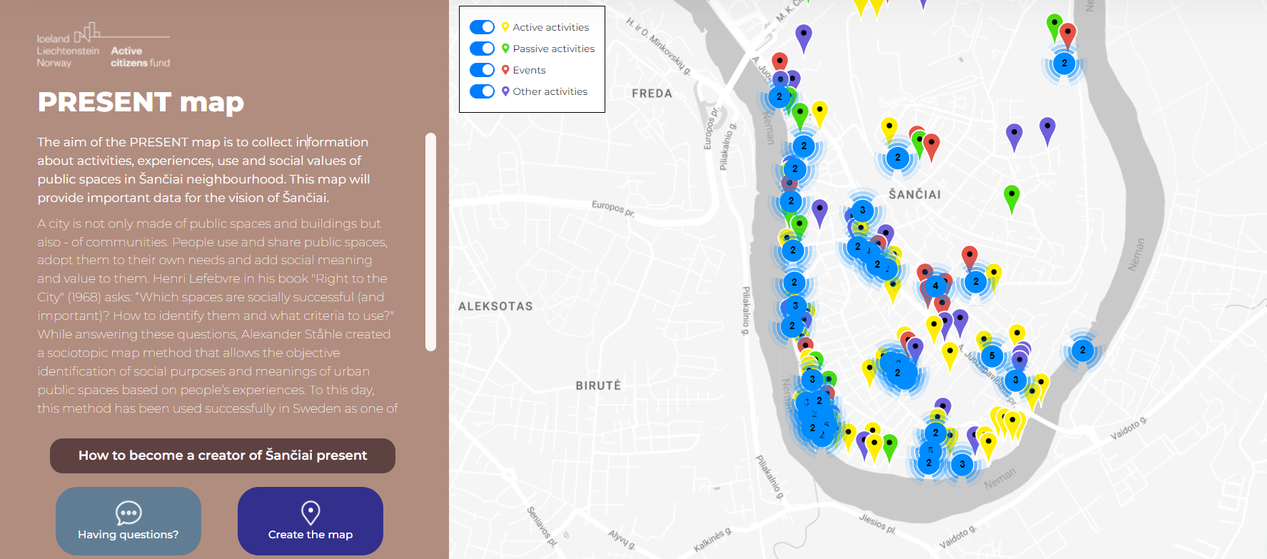
(2) PRESENT map collected information about activities, experiences, use and social values of public spaces in Šančiai neighbourhood. This map provided important data for the vision of Šančiai. A city is not only made of public spaces and buildings but also - of communities. People use and share public spaces, adopt them to their own needs and add social meaning and value to We learned “Which spaces are socially successful (and important)? To identify them we followed Alexander Ståhle’s sociotopic map method that allowed the objective identification of social purposes and meanings of urban public spaces based on people’s experiences.
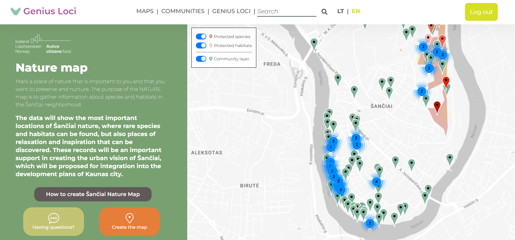
(3) NATURE map identified places of nature that are important and need both preservation and nurturing. We gathered information about species and habitats in the Šančiai neighborhood.The data shows the most important locations of Šančiai nature, where rare species and habitats can be found, but also places of relaxation and inspiration that can be discovered.
Taken together these maps create a data set that will inform a new urban vision of Šančiai.
Please highlight how this approach can be exemplary
The integration of sustainability, environment and art created the conditions for the real participation of citizens in the development of the urban and architectural conceptual project of the district: The Digital Tool is an ingredient for sustainable development and the interactive maps and over 1,000 inputs has created a new data set to help create a new urban vision for the neighbourhood; Each interactive maps - memory, nature and present - created by residents and those living in the city become integral to the spatial development of the district territory and the priorities for the use of the territories. In parallel, the creative activities for everyone were used as a key engagement process of specific target groups i.e. schools, older people, residents, people with a disability, etc. Art and cultural heritage became a tool of pedagogy to advocate for the Faro Convention, which provides that everyone has the right to the linguistic, cultural and urban environment specific to that place; for the implementation of the Aarhus Convention and the right to proper information; for the people, places and stories of local people to be heard; for the local environment to be better understood as a contributor to well being of people and planet. Together the triptych has enabled the conditions to allow all target groups to get involved in the active development of the urban vision of Šančiai district in order to determine the directions of spatial development of the district and the priorities of land use and to reconcile the needs of different countries - business, local people, settlers. Based on the results of this project, spatial planning and construction documents can be prepared, and the community of Šančiai would have a legal basis to demand compliance by and dialogue with the Municipality and developers.
1. Development of an interactive digital Memory Map; Present Map and Nature Map that targeted the community of Sanciai. It include workshops in schools, disability centres, active age groups and live and online community workshops. For instance six creative workshops too place with157 children and 39 adults involving five facilitators. Citizens were empowered to create a digital historical map data base across four epochs and all registered heritage of the area was integrated. The complex data was systematised and is available to the public and linked to geographical coordinates. In relation to the 'Sociotopic' Present Map a comparative process and result was achieved. In this case there were 569 people who participated in live workshops especially in local schools. In relation to the Nature Map another comparative process and result was achieved but was delivered solely online due to COVID 19 restrictions. Each of the interactive maps are located on a newly developed website -sanciubendruomene.lt - which becomes a platform for civic initiatives to do with urban planning and wider community activities. In 2021 it had 4050 visitors who interacted with its various mapping processes.
To support these mapping processes a series of capacity building workshops were organised which included training in specific methodologies e.g. 4 D.I.V.E. workshops about a methodology developed by the Norwegian Cultural Heritage Agency and that enable communities identify the tolerance of their cultural heritage for future development. In addition, specific capacity building workshops focused on the Heritage of Sanciai and its Value and the Nature of Sanciai were organised as well as walking tours, exhibition of photographs of the unique features of the neighbourhood e.g. highlighting the vernacular wooden house architecture of the area.
Please also explain the benefits that derived from their involvement.
This is an initiative of a community association that has no premises and no full time staff. So the project is always dependent on the investment that local people make into their own future. It is difficult to fully communicate and capture a process which involved many meetings so that people could get to know each other and reach a consensus about how to proceed. It also entailed a great deal of follow-up work that was carried out individually, yet underpinned by a shared spirit of solidarity. Actively involving people to have their voices heard in the conception, contracting and completion of the whole process is what enables the project to contribute to social transformation. We surveyed our members about their motivations to take part and the reasons were: (i) to be more active in local democracy; (ii) to protect the unique cultural and natural heritage; (iii) to safeguard the identity of the neighbourhood and (iv) to ensure that urbanisation benefits people. Local resident R. Jančiauskienė recalled: “The self-organising done by the Ž. Šančiai community was impressive; all the planning meetings had advice from various professions (architects, lawyers, cultural workers).”
In addition, the project was unique in that it was able to attract the technical support of the local university, Kaunas Technological University who were very interested in Sanciai as an urban planning process based on spatial justice. Also, when we looked inside our community we had 2 local experts who had technological competence for the development of the digital platform. We invited 1 designer from Argentina to join the digital platform team and who maintained an interface with the community throughout the process of development.
Firstly, the absence of dialogue and any process of conflict mediation highlight that self-government is built on subsidiarity, because the closer people are to a political decision, the more responsibility they should take. For example, between the European Commission and Member States there is a subsidiarity control mechanism in place to deal with conflict. It is a three-card system: green (go) when a new decision is deemed ok, orange (warning) indicating where a problem may arise; and yellow (stop) when a decision should be stopped or reversed. Such an administrative mechanism could help greatly to resolve community conflicts with local authorities. Secondly, the community’s new interactive maps create a unique data set that can resolve the local problem of uncoordinated and non-democratic urbanisation, creating conditions for direct participation of citizens in democratic processes, strengthening and enabling active citizenship for urban development. The objective is to deliver increased citizen participation in civic activities; stronger civil society capacity and greater sustainability. The key goals are fairly standard ones: (i) active engagement of citizens in decision-making; (ii) creation of a virtual community space enabling civic processes and (ii) increase in the number of users of digital tools, promoting public participation in civic activities. Fourthly, the tensions between civil society and the Municipality cry out for a public-social partnership. Put simply ways have to be found in which Municipality political and administrative representatives start addressing local people as rights holders who feel responsible for what they have in common - public land and interest. This idea echoes the views of the Special Rapporteur on Cultural Rights, Karima Bennoune (2016. A/HRC/31/59 para 9): “It’s ...to protect the conditions allowing all people, without discrimination, to access, participate in and contribute in a continuously developing manner."
The digital mapping process enabled community bonding. Too often the top down view of why community mobilisation does not take place is because of weaknesses in civil society, or non participatory culture. What we have learned is that the maps helped to express ‘bonding’ i.e. local ties that bind people together within the community. Communities need time to know what assets they have - its own people, places and stories. From the digital maps the community is then able to develop a capacity for ‘bridging’ The more more local bridges (per person) there are in a community and the greater their degree, the more cohesive and capable a community is of acting in concert. It is only by criss-crossing between its own members and institutions of representative power that social change can take effect and the community be sustained. The second area of innovation is more focused on the culture of the municipal administration and the slow-changing culture of the top-down approach within Central and Eastern Europe. Here there is need for a shift from established procedural mechanisms towards a governance (steering) process. Citizens are a group that has a legitimate, institutionalised right to have a say in governance. Too often, local governments regard participation as a one-way street, that is, they communicate their policies and decisions to their citizens rather than being attentive to bottom-up initiatives and opinions”. Visually, what can be drawn from our experience can be illustrated as a triptych in which the first panel of bottom-up mobilisation is connected to a third panel of top-down governance, by a central panel, which is the responsibility of self-governance and the binding force of culture. Here digital mapping is not a tool not for work 'in' or 'with' communities but an action 'as' sustainable community.
Please provide clear documentation, communication of methodology and principles in this context.
Our partners can share our learning and we hope we could start a new collaboration because more communities need to tell others about their people, place and stories. Thus there is potential to share something that has a public service value to others. For us, it is not an act of product commercialisation but of community mobilisation focused on the Genius Loci and the development of new urban vision for YOUR/ANOTHER neighbourhood. A digital platform (website) is a core activity of the project and each of the maps are a key facility in this platform. In terms of concept and content we partnered with the Kaunas Technological University whose expertise helped to define e.g. what epochs to use; how to format the memory and present day input. We partnered with a national environmental organisation to help us define our Nature Map. Along with the theoretical aspects we also have a technical team that translate our ideas into digital content and capability. Here too we have a process and a set of tools that we can communicate to others who are interested.
Please refer to the following links to see the process behind the development of each map which focused on persuading local people to make their mark/entry on the digital map.
Memory Map - https://vimeo.com/681844056
Nature Map - https://vimeo.com/658386071
Present Map - https://vimeo.com/645506525


@Žemųjų Šančių bendruomenė, 2022
Content licensed to the European Union.